
Two Forces, One Winter: Preparing your community for El Niño in a changing climate
For generations, an Ontario winter has carried a familiar image: snow blanketing the ground, lakes locked beneath ice, and temperatures that send you reaching for your heaviest coat.
But climate change is painting a different picture. From freezing rain to reduced snow cover, local governments and community organizations are increasingly navigating a wider range of winter conditions, making it harder to plan for the winter ahead.
At the same time, natural climate patterns such as El Niño can shape winter weather from year to year. This year, a ‘Super’ El Niño is expected to be one of the primary influences on winter weather across Ontario. El Niño is also unfolding against a backdrop of a warming climate, adding natural variability to a climate that is already changing. Together, these two forces add another layer of complexity for communities preparing for the winter ahead.
A Look at Winter Conditions Ahead
You’re likely used to checking the weather forecast to plan your day—or perhaps turning to future climate projections when planning for the years ahead. But what if you need to make a decision months in advance?
Seasonal forecasts help bridge that gap. They provide insight into likely average conditions for the next three months individually and for rolling three-month seasons over the next year. The forecasts are updated monthly, so you can check the outlook as the season approaches.
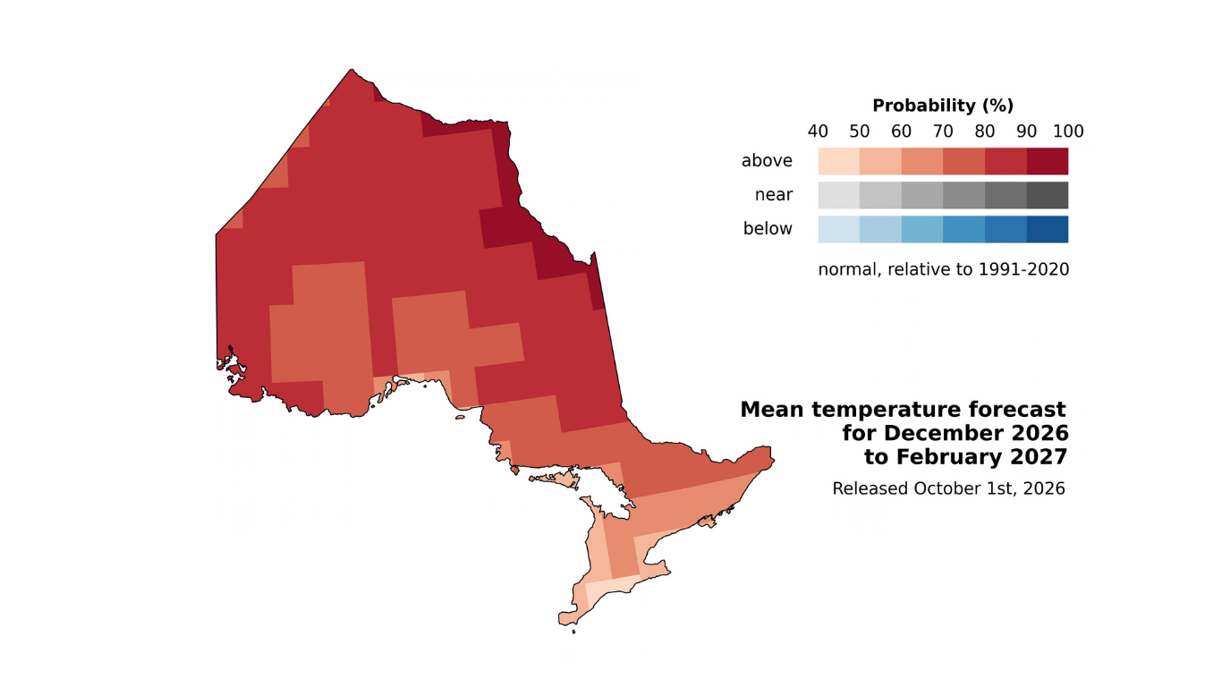
Figure 1. ClimateData.ca’s latest seasonal outlook indicates above-normal temperatures are likely across Ontario this winter, with the highest probabilities in northern Ontario. Source: ClimateData.ca.
Historically, El Niño winters have tended to bring wetter conditions to western Ontario and drier conditions in the east. This pattern provides useful context for the season ahead, and updated seasonal forecasts in November will provide a more current picture of what to expect this winter.
These forecasts won’t tell you when the next storm will hit, how much snow will fall, or whether a specific day will be unusually warm. Instead, they highlight conditions that are more likely over the season, helping you identify practical steps to prepare, support short-term decisions, and start conversations about what your community may need.
Seasonal forecasts don’t replace long-term adaptation planning—they complement it by helping you make decisions for the season ahead while keeping broader adaptation goals in view. By considering these conditions alongside their potential impacts, communities can focus preparedness efforts and make informed decisions.
The forecast isn’t the decision—it’s information to help you make a better one.
How El Niño Comes Into Play
What influences a seasonal forecast? One important factor is the El Niño-Southern Oscillation (ENSO), a naturally recurring climate pattern in the tropical Pacific Ocean and one of the major sources of predictability for seasonal forecasts.
El Niño is the warm phase of ENSO, typically occurring every two to seven years. It is often associated with warmer-than-normal winter temperatures across North America, although its influence varies by event and location.
This year, the seasonal prediction system used to produce these forecasts, CanSIPSv3, is predicting a very strong—or “Super”—El Niño, expected to peak in November or December. This strong El Niño is one of the factors shaping Ontario’s seasonal outlook this winter.
What This Could Look Like for Ontario
We don’t have to look far back to see how an El Niño winter can unfold. During the 2023–24 El Niño, Canada experienced its warmest winter on record, with parts of Ontario seeing some of the country’s largest temperature increases. But milder doesn’t always mean easier.
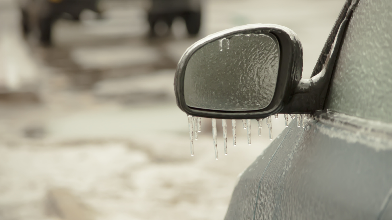
In 2024, Northern Ontario experienced delayed freeze-up, reduced ice quality, and short winter road operating seasons, limiting safe travel and resupply windows for remote communities. Central Ontario also saw a significant increase in winter rain and a decline in snow cover, creating challenges for winter recreation and increasing the risk of localized flooding and freezing-rain events, with impacts on transportation, energy, and municipal planning. Across Ontario, El Niño didn’t remove winter challenges—it reshaped them, replacing deep cold with instability, operational strain, and new management challenges.
While no two El Niños will look the same, research suggests that El Niño events can contribute to more frequent and severe extreme weather. These impacts are occurring alongside a warming climate, which is already increasing the likelihood of extreme weather events.
How You Can Prepare for an El Niño Winter
While we can’t predict exactly what this El Niño winter will bring, the seasonal outlook offers a starting point for early action. Long-term adaptation planning and action remain essential, but communities can also anticipate near-term risks and take action before impacts occur.
Use the information below to start conversations with colleagues and community partners about how an El Niño winter could affect your community and how you might prepare for the season ahead.
Operations and Infrastructure
What You Might See
-
More frequent freeze-thaw cycles that accelerate pavement deterioration and pothole formation.
-
Winter rainfall or rapid spring snowmelt increasing pressure on stormwater infrastructure and transportation networks, particularly in flood-prone areas.
-
Freezing rain events affecting public safety, transportation, and utilities.
-
Variable snow and ice conditions increasing demand for staff, equipment, and winter maintenance materials.
Actions to Consider
- Prioritize areas for inspection, maintenance, and response before winter begins.
- Identify flood-prone areas and inspect drainage and stormwater infrastructure ahead of winter rainfall and spring snowmelt.
- Review salt and sand inventories, assess salt management practices, and identify strategies to reduce ecological impacts during periods of increased ice risk.
- Review staffing and equipment needs and establish mutual-aid agreements with neighboring municipalities.
Emergency Management and Public Health
What You Might See
-
Increased frequency and severity of freezing rain, winter and spring flooding, and rapid snowmelt events, increasing demands on emergency response and public health services.
-
Rapid changes in temperatures and water levels increasing the risk of ice jams, hazardous travel conditions, traffic collisions, and weather-related injuries.
-
Overlapping events and/or cascading impacts, such as power outages or disruptions to emergency routes, affecting access to health services and other essential supports.
-
Milder winter temperatures increasing pest overwintering survival and disrupting dormancy, with implications for infectious disease in the following year.
Actions to Consider
-
Monitor local weather forecasts, flood messages, and other relevant alerts, and confirm notification procedures with emergency management and public health partners.
-
Review emergency response and communication procedures with internal departments, public health units, utilities, conservation authorities, and neighbouring municipalities.
-
Develop a public communications toolkit to support timely and consistent communication about weather-related hazards, health risks, and protective actions.
-
Use an upcoming Community Emergency Management Coordinator (CEMC) meeting to review lessons learned or conduct a tabletop exercise focused on cascading conditions and their impacts on public health, emergency response, and essential resources.
Tourism, Business and Recreation
What You Might See
-
Reduced snow and ice cover affecting the viability of winter recreation activities (e.g., skiing events, outdoor skating rinks, ice-fishing tournaments).
-
Damage to trails, parks, and other outdoor recreation spaces from flooding or winter storm-related tree canopy damage.
Actions to Consider
-
Develop contingency plans for winter programming and events, including alternative activities, locations, or dates when snow and ice conditions are unreliable.
-
Review communication and closure protocols with tourism operators and community partners to share timely safety information and manage changing conditions.
Water, Natural Assets and Forest Management
What You Might See
-
Ice accumulation during freezing rain events, causing damage to trees and vegetation.
-
Reduced snow cover, rain-on-snow events, and rapid spring melt affecting groundwater recharge, soil moisture, and increasing erosion risks.
-
Drought conditions increasing ecosystem stress and wildfire risk into spring and summer.
-
Reduced snow cover resulting in less spring snowmelt and lower water availability, affecting agricultural productivity.
Actions to Consider
-
Identify vulnerable trees, vegetation, and natural areas that could be more exposed to storm damage, wildfire, or changing moisture conditions.
-
Review vegetation and wildfire management practices and identify areas where proactive maintenance could reduce risk.
-
Review winter salt management practices and consider opportunities to reduce impacts on soil, vegetation, surface water, and groundwater.
-
Consider natural assets in climate risk planning, including how wetlands, forests, and other natural areas can help manage flooding, erosion, heat, and water-related risks.
Finance

What You Might See
-
Greater uncertainty in operational costs from winter maintenance, overtime, emergency response, and infrastructure repair expenses.
Actions to Consider
- Establish protocols to track weather-related costs and support reimbursement if disaster assistance becomes available.
- Review contingency funding and operating reserves with key departments to prepare for unexpected overtime or emergency response expenses.
Looking Ahead
If you’re looking for support in applying seasonal climate information to your operations or planning, reach out to the ORCCA Support Desk. Our team can help you navigate climate information and connect it to the decisions that matter in your community.